Hilo Bayfront Trails Inc.: Creating a Multi-Use Trail through Scenic Downtown Hilo
By Alan D. McNarie
When Peter Kubota went to the University of Oregon as an exchange student in 1982, the 46 miles of eight-foot-wide bicycle/pedestrian trails that wound around the campus, the city of Eugene, and its park system impressed him. The trails, along with 71 miles of signed bikeways, 187 miles of marked bike lanes on Eugene streets, and seven bicycle/pedestrian bridges over major highways and the Willamette River, created a safe, scenic alternative transportation system for the city, as well as a major recreational resource and source of civic pride.
Someday, he vowed, he would do something like that for Hilo. Peter is now a successful Hilo lawyer, and his dream is inching toward fruition. The state, the county, and a nonprofit that Peter heads called Hilo Bayfront Trails Inc. are collaborating to create an integrated network of bicycle and pedestrian pathways that will eventually link much of Hilo from the Wailuku River to Keaukaha.
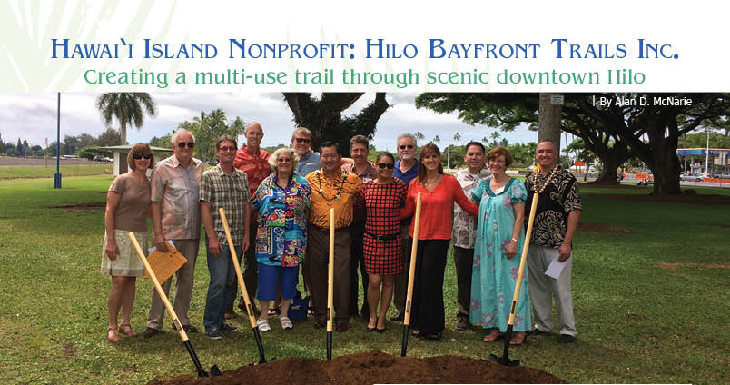
Last July, a groundbreaking was held near the Mo‘oheau Bandstand for the first section of the new trail system, which is now under construction.
“The entire system may be envisioned as a series of lei, linked in loops and tying together our community’s history, scenery, recreational activities and the exquisite open space areas fronting Hilo Bay,” reads the Hilo Bayfront Trails website. “The Trail will provide a variety of multimodal paths, pedestrian sidewalks, dedicated bicycle lanes, and shared roads for bicycles that will function as a cohesive trail system for pedestrian and non-motorized transportation between Hilo Harbor and Downtown Hilo. It will complement and highlight the outstanding attributes of the Hilo Bayfront area…. Aside from the trails themselves, the project will include new parking areas and interpretive signs and displays denoting areas of historical and cultural interest.”

When it’s completed, the makai portion of the trail system will stretch all the way from Mo‘oheau Bus terminal to Reed’s Bay and link up with existing footpaths around Banyan Drive, Lili‘uokalani Gardens, and Moku Ola (Coconut Island). Inland segments will circle Wailoa Pond and visit other sections of the park, including Wailoa Center, the Tsunami Memorial, and the King Kamehameha Statue. It will be possible to bike or walk from downtown Hilo to the County Building and to the Banyan Drive Hotels, without ever venturing onto a highway aside from an occasional crosswalk. Future extensions could take the system to the Keaukaha beach parks and the University of Hawai‘i Hilo.
Compared to the Eugene system, the Bayfront Trail System would be relatively modest—about six miles of trails. The group hopes that it will only be the beginning.
“It is also envisioned that the completion of major segments will inspire the creation of additional trail segments,” states the website.
It’s still got a long way to go—yet given the incredible complexity of the project, with its multiple state, county, private, and nonprofit players, simply bringing everyone together and coming up with a consensus plan has been a major accomplishment in itself. The next, equally complex challenge is to find the funding for the entire system, and some major strides have been made there, as well.
After Peter got back to Hawai‘i, he joined a local bicycling organization—“a bunch of gearheads,” he calls them affectionately. In about 2006, the group got invited by then-mayor Harry Kim to attend a meeting with the County Departments of Planning, Public Works, Transportation and Parks and Recreation, the Police Department, the State Departments of Transportation and Parks, and stake holding groups such as bicyclists, soccer clubs, and canoe clubs, to talk about a possible trail system around Hilo Bay.
“The meeting was to discuss if there was community interest in planning a trail,” says Peter. When the mayor’s representative asked the groups if they wanted to do the trail, he recalls, “Everybody in the room said yes.”
The very diversity of the groups who came to the table for that first meeting illustrates one of the big challenges for the trail system. Part of it is on state-controlled lands such as Wailoa State Park, which the state maintains on the site where the 1960 tsunami wiped out downtown Hilo. Other sections will run over county lands, such as the parcel under Mo‘oheau Bandstand and downtown bus station. Still other segments at least border on private property, such as the Banyan Drive hotels. Bringing the plan to fruition will require close cooperation between an alphabet soup of state and county agencies, as well as a plethora of nonprofits, companies, and individuals.
Spurred on by a small yet determined core group of backers, County Research and Development applied for, and received, a $120,000 grant to plan the trail, and hired an outside consultant to draft a sketch of the planned trail. Community meetings were held to get public input on the proposal. The master planning process took from 2007 to about 2011. Beth Dykstra of County Research and Development shepherded the plan through the Shoreline Management Access Permit process, and the permit came through in April 2011.
Still, Peter worried, even if the spirit was willing, the funding was weak. “We had a good plan, but the government didn’t have any money to do it. Realizing that government had just come through the worst recession in history and had no money, we formed a nonprofit to build a trail and give it back to the state and county. All of the players who volunteered through 2011 are still on board, helping to get this trail built.”
It turns out that the group hasn’t had to go it alone, after all. Peter says, “Both the state and county have come forward with money to help build this trail.”
Several state senators got behind the plan, including Hawai‘i Island Senator Gill Kahele and Water and Parks Committee Chair Donovan Dela Cruz. The State Parks Division came through with $2.5 million in capital improvements funding to renovate Wailoa State Park, including pavilion renovation, parking lot repairs, and a section of the trail by the Wailoa pavilions.
Meanwhile, the county has been busy with a little help from the Federal government.
“County Parks and Rec has put a staff person on a grant application from National Park Service for $370,000 for a matching grant,” says Peter. “That will fund construction of Phase 1, from the bandstand and canoe hales (houses), then around the mauka (toward the mountain) soccer fields to Pauahi Street.”
The group has also received a pledge from the Ed Olson Trust for another $250,000 matching challenge grant.
Matching funds are just that—they have to be matched by other donors before they can be touched. Peter estimates that Hilo Bayfront Trails will have to come up with another $500,000–$1 million to build the entire trail system.
The group is actively soliciting more grants and public support. Its members meet monthly, usually at the conference room at the Hawai‘i County Planning Department, to monitor the progress of the fundraising efforts and of the building of the trail itself, now that construction is finally underway. ❖
Contact Peter Kubota and Hilo Bayfront Trails Inc.
Contact writer Alan D. McNarie
Alan D. McNarie
Alan McNarie has been living on the Big Island since 1988, and has written hundreds of investigative and feature articles for Ka'u Landing, the Hawai’i Island Journal, Hana Hou, Ke Ola and other magazines and newspapers; he's also written two novels, including the recently published The Soul Keys, (Hilo: Larry Czerwonka Co., 2015), a satiric fantasy set, like his life, in Missouri, Hawaii and parts between. His first novel, Yeshua (New York: Pushcart Press, 1993), won the prestigious Editor's Book Award. McNarie holds a PhD in Modern Literature fom the University of Missouri—Columbia. Alan lives in Volcano with his love, Kersten Johnson, and their five feline companions.