Halema‘uma‘u Tribute
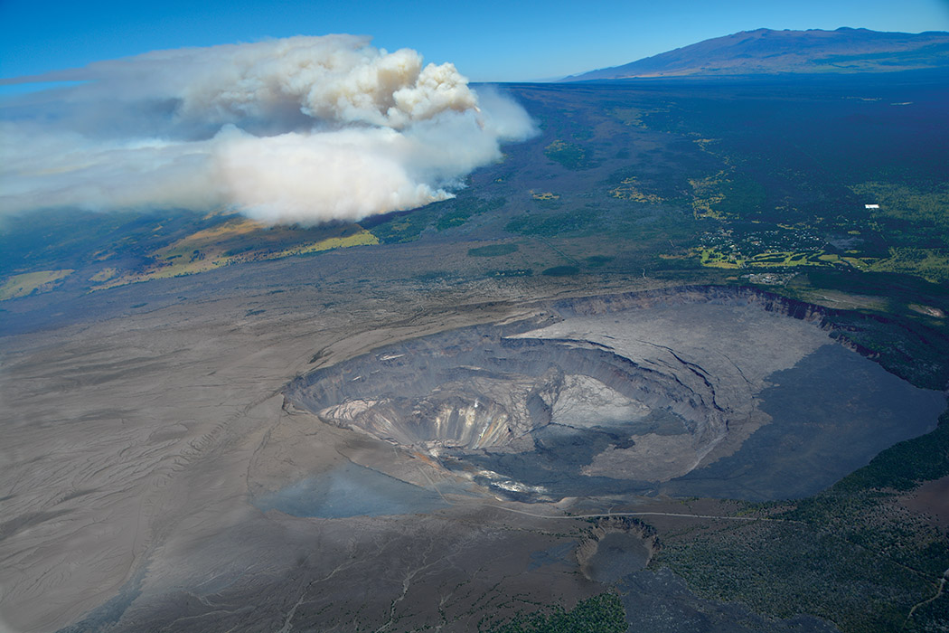
August 7, 2018: Civil Air Patrol captured this image of Kīlauea’s summit, providing a stunning view of Halema‘uma‘u and the collapsed area within the caldera. Prevailing trade winds have blown much of the ash emitted during earlier explosions to the southwest (left), where thin layers of light-colored volcanic ash now blanket the landscape. Plumes of smoke rising from the flank of Maunaloa were from a brush fire. Maunakea is visible on the upper right horizon.
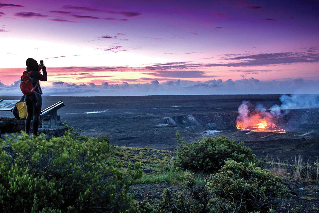 April 24, 2018: Taking advantage of no crowds at sunrise!
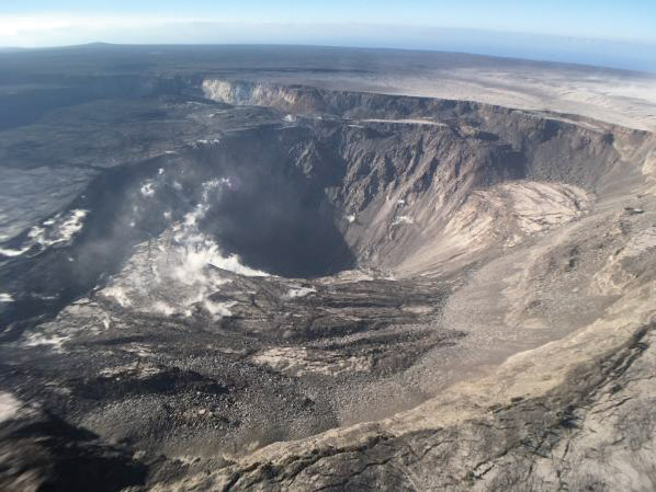
August 2, 2018: Kīlauea’s summit remains quiet following the collapse event. This quiet is a significant departure from the pattern of episodic seismicity and continuous deformation over the past several months, with very low rates of seismicity continuing today. Deformation at the summit as measured by tiltmeter and GPS instruments slowed and virtually stopped between August 4 and 5. This view of Halema‘uma‘u is toward the southeast.
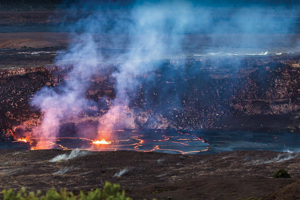 April 23, 2018: The lava has receded into the vent but remains very high. Hot lava is still seen to the right of the vent. What a way to commemorate National Park Week 2018!
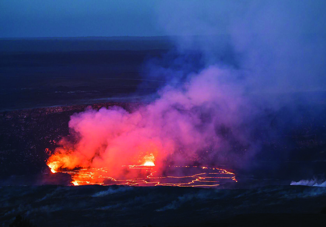 May 1, 2018: The summit lava lake is unchanged and has risen overnight to just below the rim of the Overlook crater vent, as seen in this photo.
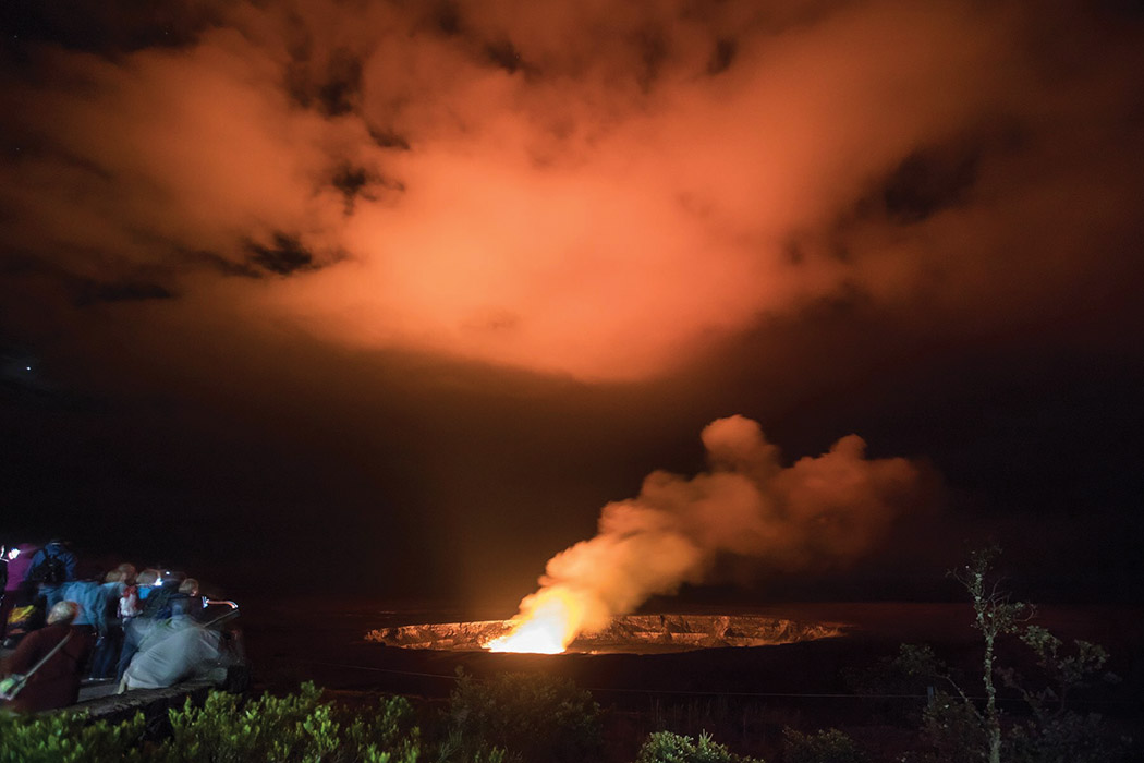 May 7, 2018 Visitors at Jaggar Museum overlook on Sunday evening enjoy the glow emanating from the lava lake deep within Halema‘uma‘u Crater.
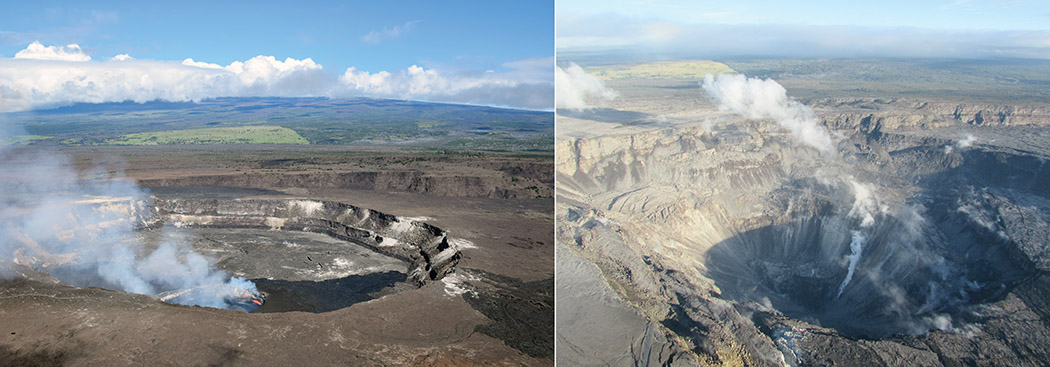 April 13, 2018: Halema‘uma‘u, as we once knew it, and the active lava lake within the crater is visible. At right is a comparable view captured on July 28, 2018, following recent collapses of the crater. The Hawai‘i Volcanoes National Park Jaggar Museum and USGS-HVO can be seen perched on the caldera rim (middle right) with the slopes of Maunaloa in the background.
Photos courtesy of U.S. Geological Survey