Then & Now: Kaimū Beach, Kalapana, Kapoho–The Only Constant is Change
By Stefan Verbano
Through a break in the shrubbery beside Highway 130, the lava field reveals itself for the first time.
After a long, gradual bend in the road heading downhill from the turn to ‘Opihikao, strawberry guava-laden jungle falls away for a few hundred feet and it feels as if the whole world has opened up. Far off in the distance, ripples of lava long since cooled mix with oases of green scrub that roll down to meet the ocean of tiny white-tipped waves.
Manmade incursions are few from this vantage point. Several dozen simple rectangular buildings are scattered throughout the lava field, most with roofs and sides of differing colors. On one side of the field, tall stands of coconut palms throw shade on the barren, almost lunar landscape.
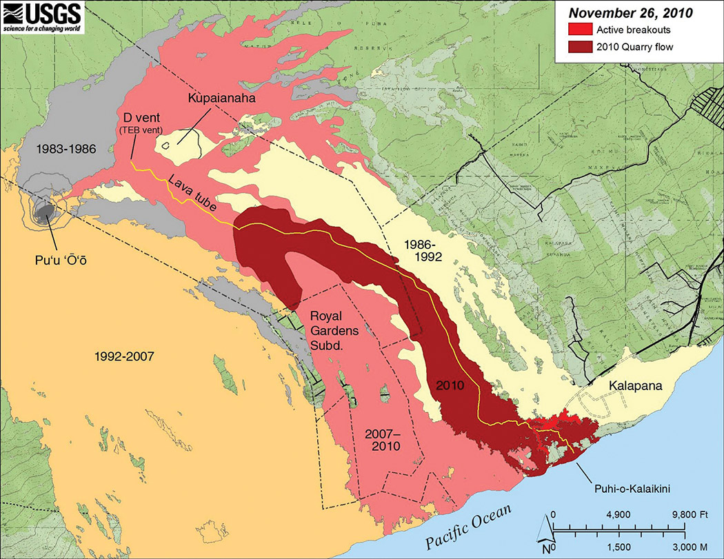
This is Kalapana’s lava field, what remains of the towns of Kalapana and Kaimū after the devastating 1990 lava flow that destroyed more than 150 homes over a 10-month period. Prior to that, the eruptions from Kīlauea’s Pu‘u ‘Ō‘ō vent beginning in 1983 were mostly contained within Hawai‘i Volcanoes National Park (HVNP) boundaries, until three years later when a lava tube feeding magma to Pu‘u ‘Ō‘ō ruptured, forming the Kūpa‘ianahā vent two miles down rift.
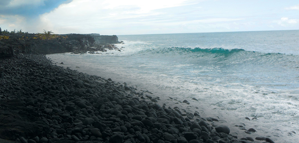
This new vent sent lava farther east, eventually pouring it into the streets of Kalapana covering cars, homes, parks and stores beneath rock 85 feet deep in some places. The flow pushed through Kalapana eastward out into the sea, destroying most of Kaimū town and its world-famous black sand beach, filling in Kaimū Bay, and creating a new coastline 1,000 feet wide.
In early 1991, new lava tubes diverted the flow away from Kalapana and back into the HVNP. The eruption from Kūpa‘ianahā declined steadily over the next year until the vent finally died in early 1992 and the eruption was once again confined to Pu‘u ‘Ō‘ō.
For years the inundated land lay almost vacant. Some families chose to stay and live on the outskirts, and others have since moved back to Kalapana’s lava field, built small off-grid structures, and planted baby coconut palms and other tropical flora in the barren waste. Over the years the community feel has revived.
Kīlauea’s New Flow
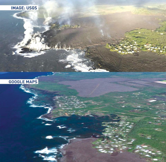
On a windy afternoon in mid-July, 2018, seen from the cliffs of rounded lava boulders above the crashing waves of the new Kaimū beach, Fissure 8 smokes in the distance. Nearly three decades after Kaimū’s destruction, Kīlauea is once again sending lava ripping through lower Puna subdivisions, this time in Leilani Estates, Lanipuna Gardens and the Greater Kapoho area.
Fissure 8 is the last active fissure of what is being called the “2018 Lower Puna Eruption,” which started in early May when 24 fissures opened within and near Leilani Estates and Lanipuna Gardens subdivisions. The eruption covered almost 14 square miles, destroyed roughly 700 houses, caused more than 2,000 residents to evacuate and created about 875 acres of new oceanfront land stretching from Kumukahi Lighthouse several miles south to Pohoiki Bay.
As of mid-August, the flow had declined significantly, with only sluggish oozing into the ocean and a nearly crusted-over lava pond within Fissure 8’s 100-foot-tall cinder cone.
While standing on this ledge of newly created land—feeling the concussion of waves pounding the black cliffs, hearing the rumble of smooth lava stones the size of engine blocks tumbling as each wave crests and rolls back out again, watching Madame Pele, Hawaiians’ volcano deity, destroy and create underneath a cloud of burning forest and sulfur far away on the horizon—a peculiar feeling starts to permeate the air. It is the feeling of continuity; of equanimity; a feeling of humble awe at seeing the primordial forces of nature at work, past underfoot, present in the distance, which dredged up from the ocean’s depths this magical, isolated island chain unlike any other place on Earth.
Kaimū and Kalapana Communities Revive
From the new Kaimū beach, it’s a quarter-mile walk across footpaths paved with red cinder stones, over hills of cracked, ropey lava, to get back to the main hub of Kaimū: a handful of parking lots, a convenience store, an art gallery in the back and a sprawling open-air complex operating every day which hosts Kalapana’s famous Wednesday night market.
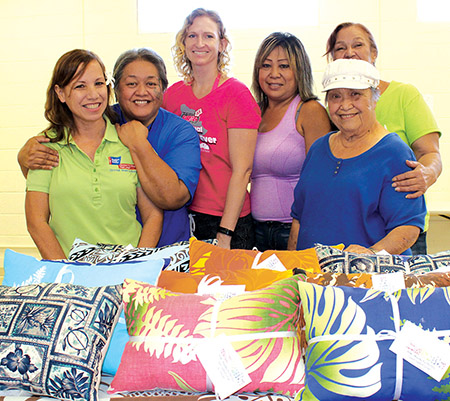
The entire compound, including the Wednesday night festivities, are affectionately referred to as “Uncle Robert’s” in honor and memory of the beloved patriarch of old Kalapana Village, Robert Keli‘iho‘omalu.
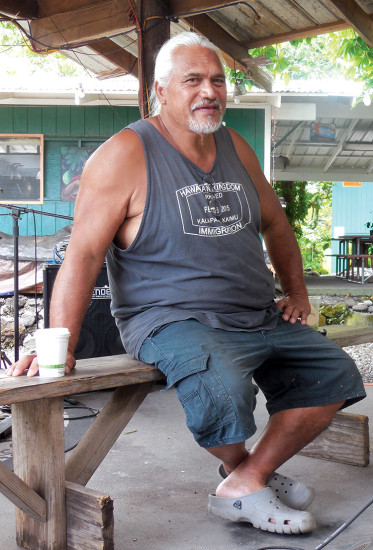
On a Sunday morning in late-July 2018, Uncle Robert’s son Samuel Keli‘iho‘omalu sits at one of the picnic tables in the main market area while church services wind down onstage. Just a few paces away, a framed portrait photograph of Uncle Robert hangs over the bar, fringed with polished seashells, showing his fatherʻs warm eyes, closed-mouth grin, salt-and-pepper goatee and Crocodile Dundee hat.
“Uncle Sam,” as everyone seems to call the 54-year-old burly Hawaiian, moved from the Kaimū area to the mainland in 1989 as a young man, evading most of the Kūpa‘ianahā vent’s destruction. However he would return in the summers to visit, and watched as the communities slowly rebuilt, replanted, and attempted to make the lava field inhabitable again.
Uncle Sam was instrumental in the replanting efforts focused around the new Kaimū beach trail, where now patches of papaya trees, coconut palms, ornamental ginger, Monstera vines, noni plants, ti plants, kukui nut trees, and breadfruit trees thrive.
When asked whether he views the lava flows as something tragic, Uncle Sam answers with an unfurled brow, “To me, it’s just Mother Nature doing her thing,” he says. “You can’t think about the other side of it … just get the hell out of the way and let it go.”
Coming from a family that survived one catastrophic lava flow, speaking to those currently being affected by another one, Uncle Sam offers this consolation, “Everybody has to give themselves hope,” he says. “Theyʻve gotta put hope in themselves, and that life keeps on going. It is devastating because it’s home … you’re gonna be devastated for a while, but you’ve got to move on.”
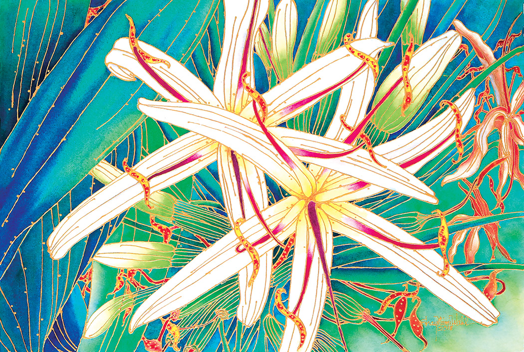
At the other end of the property, Joel Corley works in the House of Fire Art Gallery. He’s a 31-year-old Colorado native who moved to the Kalapana area in 1997 and witnessed the post-destruction, isolation and slow revitalization of Kaimū from its earliest stages.
“It was very traumatic,” Joel says. “Lots of people felt like they lost a lot of beautiful spots … everyone talks about how beautiful it used to be.”
He has watched the population of Kalapana grow tremendously over the past decade from humble beginnings, recalling a time when farmersʻ markets were barely on their feet and most of the area was still deserted. “It was no man’s land in 1998,” he says. “I remember when [the market] used to be just three vendors.”
Joel is a glass blower. Before the May 2018 eruptions, the art studio featured pieces from more than 40 artists including his own. Now the studio is down to 12 artists, its walls boasting ceramic bowls, fine jewelry, photography, slumped glass pieces and more. After the powerful earthquakes at the recent eruption’s start, some artists have left the studio and even lost homes in the current flow.
“Try to figure out a new normal,” he offers as advice to victims in the Leilani and Kapoho areas, “because it will never be the same again.”
Lessons of Kapoho
Twenty miles northwest of Kalapana as the crow flies, up the slopes of Kīlauea in Volcano Village, Serge Kahili King’s teacups clatter quietly atop their saucers. Serge lost his home in Kapoho to the current flow almost two months prior, and on this late-July day he’s in the midst of packing up and moving the fine art pieces in his Volcano home into safekeeping, in light of the near constant earthquakes shaking the summit.
Serge was on Hawai‘i Island that day in 1990 when the flows entered Kaimū Bay. He was here visiting friends who had a house in the Kalapana area on Highway 137, or the “Red Road,” and were working in Hilo the day the lava came.
“So they left for work that day, and the prognosis at the time was that it might reach Kalapana and that area in six months,” Serge said. “They went to work that day, and when they came back, it was all covered. And the bay was filled in already.”
He arrived in Kalapana after sunset, and vividly remembers watching as the Star of the Sea Painted Church was trucked out of town on a big flatbed, saved from the advancing flow.
Serge may have witnessed Pele’s rapid destructive power objectively from a distance in 1990; however, three decades later, it hit him very close to home. He lost what he calls “a beautiful, beautiful house” in Kapoho Beach Lots over the course of a day when Fissure 8 sent rivers of lava cascading down the hill toward Four Corners in early June 2018, paralleling Highway 132. In a tragic story reminiscent of his friends’ past peril in Kalapana, Serge left his Kapoho house in late May thinking he would see it at least one more time.
“We picked up a few things, planning to come back next weekend to get the rest,” he said, “and in 24 hours it was gone … there was no indication that it was coming over that fast.”
When asked if he sees some similarities between the 1990 and 2018 flows, Serge says the spirit of aloha has been undoubtedly strong among the victims of both disasters.
“I can understand from being part of a community that was overrun how it must have been for them, because the people did come together, everybody was helping each other … and I suspect it must have been exactly the same thing [in Kalapana]. The people are always helping each other. It’s part of the trait.”
His words of solace for those currently being affected are befitting for a wise man, no doubt refined over the course of many years of advising, helping, healing and listening.
“This is a live volcano—it erupts,” Serge says. “And here we are living in this absolutely gorgeous place, which is inherently dangerous, so I try to get them to remember the good parts of having lived here and the benefit of having spent so much time here, but not to live in regret. This is a changeable island, and change is part of the life here. And we can sit with each other and talk about how wonderful it was, but then we have to move on … to whatever new things are going to be in our life.” ❖
Stefan Verbano
Stefan is a writer, musician, world traveler and farmer living in the jungles outside Kapoho in East Hawaii Island. He holds a B.A. from the University of Oregon School of Journalism and Communication in news editorial and magazine journalism, and is a Returned Peace Corps Volunteer, Zambia (2012–14). When not picking his banjo or juicing sugarcane, Stefan is learning to surf, tending to his fruit trees, hiking out to newly forged lava beaches, riding his motorcycle, or doing research for a Ke Ola Magazine article! He is from the San Juan Islands in northwest Washington, and has worked for the magazine since 2018 when he got his start covering the 2018 Lower Puna Eruption.