Beloved & Humble Puna Stronghold—o Pohoiki
By Marcia Timboy
“On her way to Kīlauea, Pele initially carved out a crater called Malama, inland of her landing place at Keahialaka. Pele was dissatisfied with this crater, and proceeded to excavate another nearby crater called Pu‘ulena, which she was also displeased with. Yet another crater dug by Pele was called Pohoiki, translated as ‘small depressionʻ” (Pukui 1974). “This crater was also abandoned as she continued her pursuit for a suitable home” (Westervelt 1916).
It is said that Pele (goddess of fire and volcanoes) likes to revisit her path to the coastline whence she first made landfall.
“Pohoiki still stands!”
This joyful Facebook post on August 6, 2018 by Ikaika Marzo, a community leader with deep Puna lineage, was seen and shared by thousands. Months earlier a devastating lava eruption changed the lower Puna landscape, as it has done for eons before. Farms, businesses, and more than 700 homes were destroyed—displacing approximately 2,000 Puna residents. Kama‘āina (local residents) and a worldwide audience watched as lava flowed along Kīlauea Volcano’s east rift zone and moved across the Puna coastline to the sea, but Pohoiki was spared—the lava miraculously stopping some 500 feet from its boat ramp.
Historical Landscape

The ahupua‘a of Pohoiki and Keahialaka are two of some 50 traditional land divisions in the district of Puna on the east side of Hawai‘i Island. They are situated along the southern margin of the east rift zone, covered primarily by Holocene lavas composed of Puna Basalt that originated from fissure eruptions less than 750 years ago. The lava flows in these two ahupua‘a occurred in 1790, 1955, and most recently, May–August 2018. Puna is described as an agriculturally fertile land that has been repeatedly devastated by lava flows.
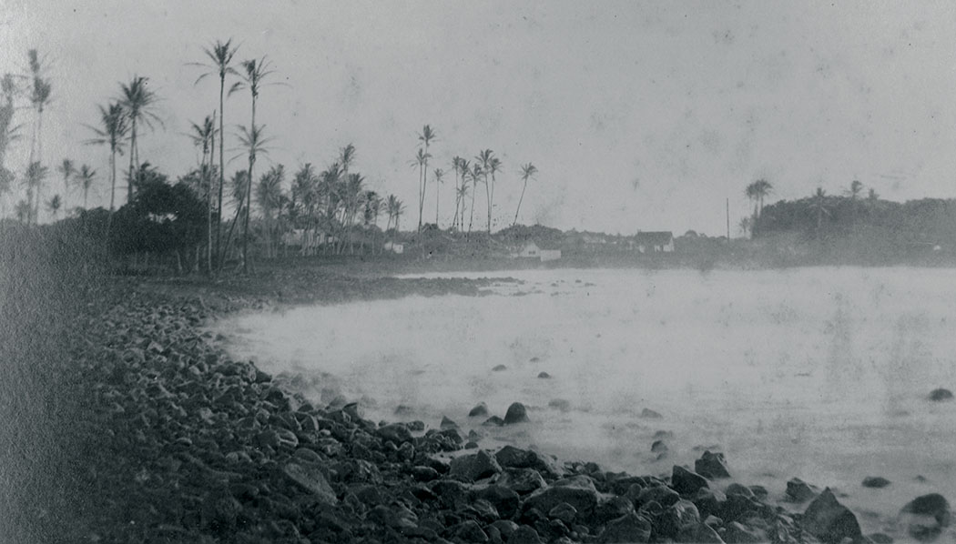
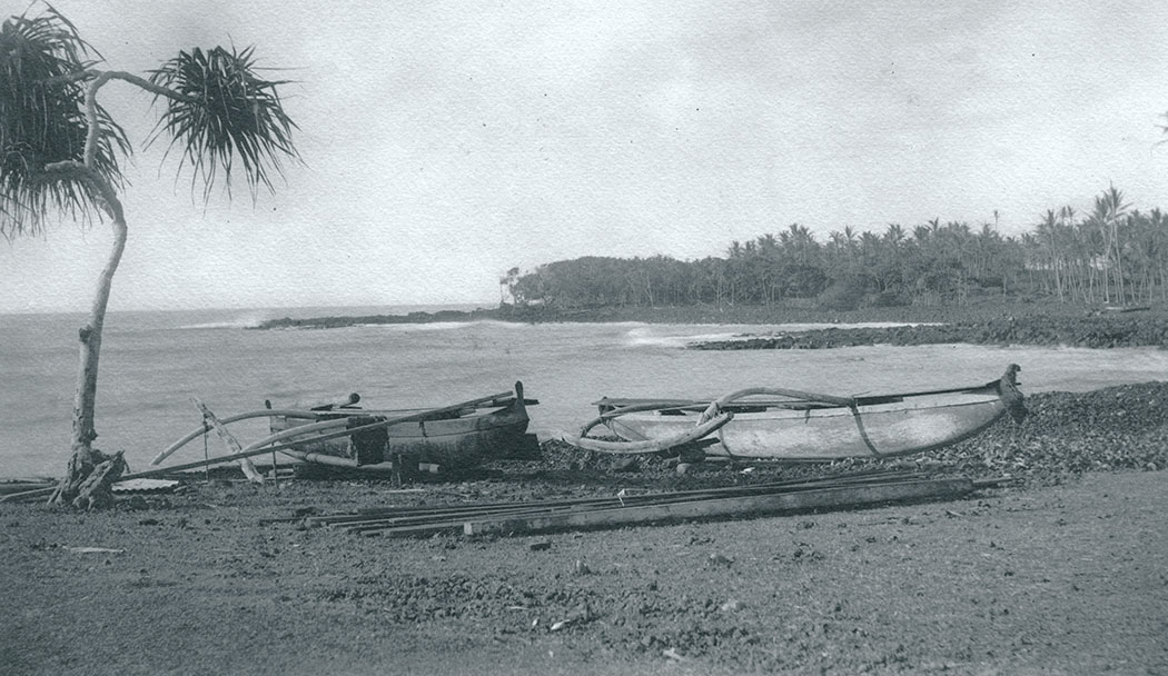
These two ahupua‘a include not only the land area with vast agricultural and forest resources, but also extend out to the ocean fisheries fronting them. Residents of these ahupua‘a from pre-contact to the mid-20th century were once able to procure nearly all that they needed to sustain their families and community. The ahupua‘a resources in turn helped support the ali‘i that ruled the district of Puna (Maly 1998). The best landing (historically) along the entire southeastern shore of Hawai‘i Island is situated along the shores of Pohoiki Bay.
Cultural Landscape and Significance
Despite its perceived lack of importance with respect to the emerging political history of Hawaiian leadership, Puna was a region famed in legend for its associations with the goddess Pele and god Kāne (Maly 1998). However, the association with Kāne is perhaps more ancient. Kāne, ancestor to both chiefs and commoners, is the god of sunlight, fresh water, verdant growth, and forests. It is said that before Pele migrated to Hawai‘i from Kahiki (Tahiti), no place in the islands was more beautiful than Puna. Contributing to that beauty were the groves of fragrant hala and forests of ‘ōhi‘a lehua for which Puna was famous: “Puna pāia ‘ala i ka hala (Puna, with walls fragrant with pandanus blossoms) is a place of hala and lehua forests. In olden days the people would stick the bracts of hala into the thatching of their houses to bring some of the fragrance indoors” (Pukui 1983). The inhabitants of Puna were likewise famous for their expertise and skill in lauhala weaving.
The Hale ‘Ohana and the Red House
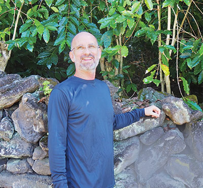
“Pohoiki is our ancestral home,” states Earl Hale (ha lay) at a talk story session in preparation for this article. Earl, along with his sisters Hana and Nani, shared their memories and insights of life along the lower Puna coastline.
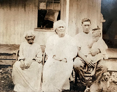
Although Earl, Nani, Hana, and their siblings grew up on a more agricultural homestead in Kapoho, Pohoiki was where their kūpuna (grandparents and great-grandparents) resided and practiced a traditional fishing lifestyle.
The iconic red house (built in the mid-1800s by Robert Rycroft, an agricultural entrepreneur from Leeds, England) fronting the Pohoiki boat ramp has been in the Hale ‘ohana (family) for generations. The house has been a gathering place for their celebrations, births, reunions, and funerals. They also put on an annual Labor Day fishing tournament off the Pohoiki boat ramp. As true kama‘āina (original settlers), the Hale ancestors were in the area long before the house was built. The Hale generational ties to Pohoiki run deep, and they have always mālama (cared for) the place, which includes the family gravesite up the road from the village. The Hale ‘ohana have long endured the immense changes Pohoiki has gone through.
In an interview conducted by ethnographer Kepa Maly in 1998, Uncle John Hale explained that during his childhood his was the only family residing on the makai (ocean side) portion of Pohoiki ahupua‘a. The son of Isaac Hale and Hanna Kawaiaea, he was born in 1919. Uncle John was raised by his kūpuna, who were dynamic, hard-working mahi‘ai (farmers) and lawai‘a (fishermen), cultivators of Pohoiki’s natural resources. Both John Hale and Gabriel Kealoha were interviewed in Hawaiian and English for Kepa Malyʻs story. They shared rich detailed narratives of the area, a result of their personal knowledge of the lands, people and practices of the Pohoiki-Ahalanui vicinity.
“Uncle John Haleʻs memory associated with agriculture and fishing are historically accurate, providing a link to the past. Both Uncle Hale and Uncle Gabriel were taught native traditional practices of stewardship for land and fishery resources.
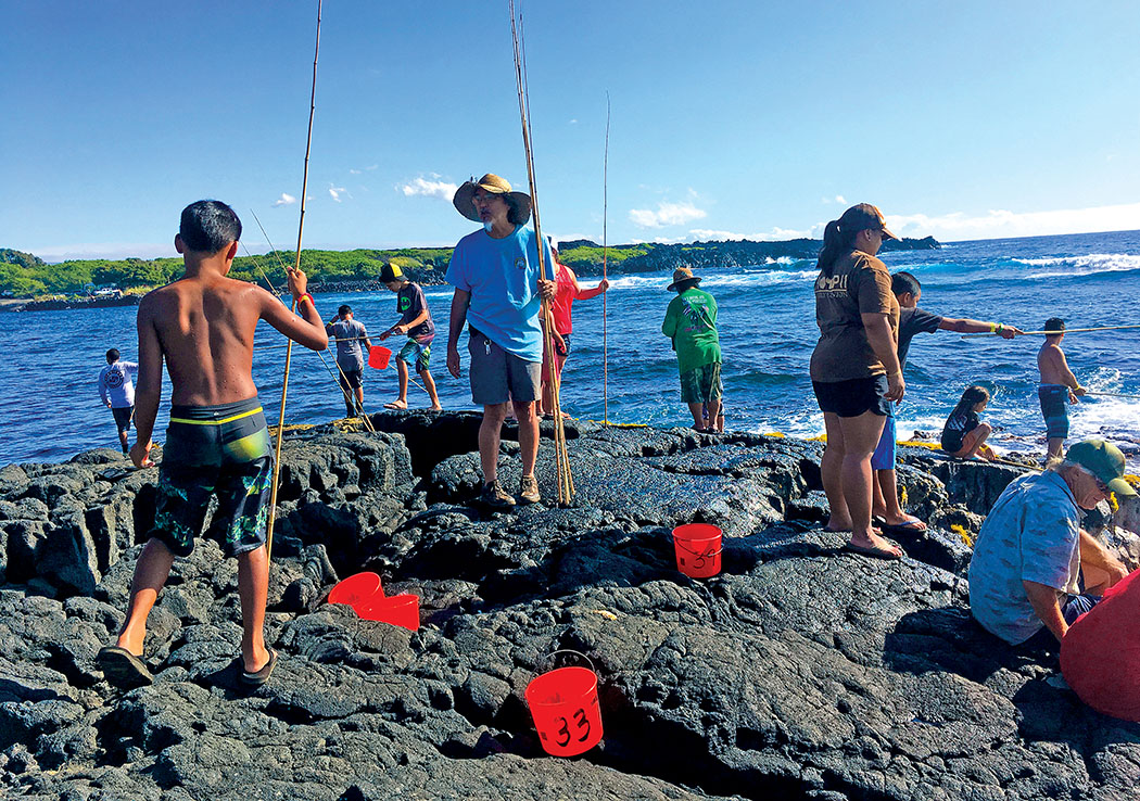
“Fishing was an important occupation for the old families. There are several ko‘a ‘ōpelu—dedicated ‘ōpelu [mackerel scad], fishing stations, which were fed and cared for—between ‘Ahalanui and Keahialaka that the families used when they were young. Throughout the days of their youth, these ko‘a were cared for by various kūpuna. Kealoha specifically stated that each ko‘a was cared for by a particular family, and associated with the particular ahupua‘a which it fronted. The Hales and Kealoha stated that out of respect for the families who cared for ko‘a, no one from other lands would fish those ko‘a; that was the traditional way. There were always so many fish, not like today. The bait used by the area fishermen were the ‘ōpae‘ula [red shrimp] which grew in the anchialine ponds of Wai‘opae in Kapoho, and in the pond at Keahialaka. In those early days, the ‘ōpae‘ula were the only bait used for ‘ōpelu fishing. Up through the 1950s–1960s, the fishermen who came to Pohoiki generally respected the Hale family’s fishery rights. Whenever anyone went fishing, they would always approach the Hales first, and upon returning, would always bring fish to share [this is a deeply rooted cultural practice]” (Maly 1998).
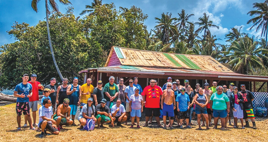
On July 28, 2018, Hale descendant Hana Pau, and other members of the Hale ‘ohana, were brought by boat to Pohoiki to say aloha ‘oe (goodbye) to that wahi pana (storied place). They arrived on the aptly named ‘Ohana, a tour boat from native Hawaiian-owned Kalapana Cultural Tours. It was an especially poignant experience for Hana, to find the “red house standing alone waiting for ‘ohana,” while the lava approached nearby.
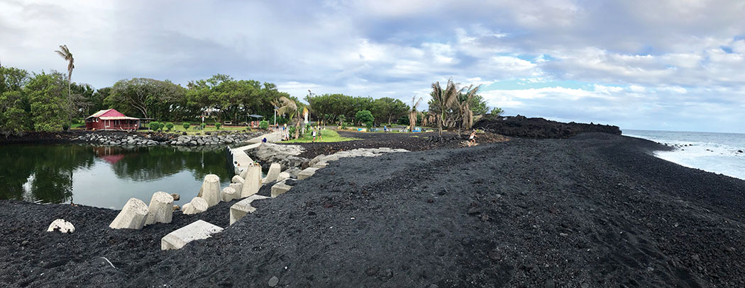
Miraculously, after almost three months of lava flowing directly towards it, Pohoiki and the red house are still there—part of this ever-altering island landscape. Now a spectacular new black sand beach encases the boat ramp creating a pond, which unfortunately is not ideal for swimming because of possible bacteria, and shoreline entry is not recommended due to strong currents and unpredictable water conditions on the ocean side. “The sand is a ho‘ailona [omen or marker],” said Hana Pau. Is it an indication of what has transpired as a foretelling of what is to come.
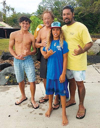
Fishermen, Surfers, and the Others…
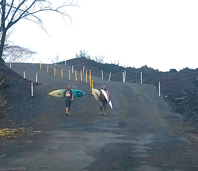
Pohoiki, renowned for its abundant fishing grounds, is also esteemed for stellar surf conditions. As of this writing in November 2018, the surfers, fishermen, and residents are returning to their beloved place. Recovery efforts from the recent lava flow are gradually moving forward; the first, excavating and grading the lava covering Highway 137, was completed in early November.
Utilities still need to be restored to Isaac Kepo‘okalani Hale Beach Park, a popular recreation facility, named after the war hero and member of the Hale ‘ohana. Accessibility will bring more and more people to this now “fabled” place.
Many kama‘āina o Pohoiki, including local fishermen and surfers, are wary of visitors populating the presently pristine lava environment. They believe that the ever-present Tutu Pele destroys and creates. As a kama‘āina o Pohoiki surfer-fisherman who requested anonymity said, “She [Pele] took all that away, and gave us this for the kids, for the future generations.” ❖
For more information:
hwy137redroad.org/pohoiki-parcel-archeological-survey/
Recollections of Puna Fisheries and Native Fishing Customs, Interviews at Pohoiki, Puna with Kepa Maly, (KPA Photo No. JH-GK061298), June 12, 1998 (with notes from June 5, 1998)
Native Planters in Old Hawaii [by] E. S. Craighill Handy and Elizabeth Green Handy. With the collaboration of Mary Kawena Pukui. Honolulu, Bishop Museum Press, 1972.
Fragments of Hawaiian History [by] John Papa Ii. Translated by Mary K. Pukui and edited by Dorothy B. Barrère. Honolulu: Bishop Museum Press, 1959.
facebook.com/story.php?story_fbid=2027196150632259&id=100000256819861
Marcia Timboy
Marcia Timboy grew up in Kona on Moku o Keawe with a childhood full of island-style activities: ocean swimming, body boarding, fishing, surfing, hula, camping, hiking, and exploring our natural island environment, shaping a lifestyle, based on a reverence of nature and respect for the cultural diversity of Hawai‘i. She graduated from Konawaena High School and the University of Hawai‘i with a BFA in painting. Marcia is an active member of our regional culture and arts communities. She writes stories on the history and cultural practices of our island, from a perspective melding local style sensitivity with deep community connections.