Ka Puana: Images of America—Hilo
By Karen Valentine
Cracked and fragile, the photographs sit in folders waiting to be carefully handled. Peering at handwritten notes several centuries old, I see that someone cared enough to leave a trace of history…
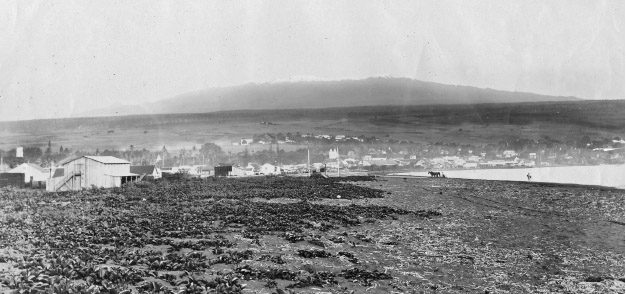 A c. 1895 photograph shows a broad view of Hilo and Hilo Bay, with Mauna Kea in the background. In the foreground is a marshy area near Waiakea Stream and Pond, where taro was once grown and today is filled in.
Native Planters in Old Hawai‘i describes how, “in the marshes surrounding Waiakea Bay, east of Hilo, taro was planted in a unique way, known as kanu kipi. Long mounds were built on the marshy bottom with their surface two or three feet above water level. Upon the top and along the sides of these mounds taro was planted. Flood waters which occasionally submerged the entire mound are said to have done no harm, as the flow was imperceptible.” (Photo: Hawai‘i State Archives)
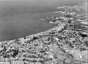 An aerial view of Hilo Harbor in the 1940s shows the entire harbor and the breakwater. The calmer water inside the breakwater has a lighter shade than the water beyond the seawall. (Courtesy of Hawai‘i State Archives.)
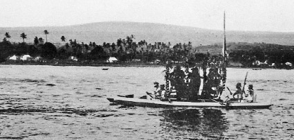 This postcard image shows the queen arriving in a canoe at Hilo Bay on an unknown date.
She donated the 30-acre site now known as Lili‘uokalani Park and Gardens on Banyan Drive adjacent to the Hilo Hawaiian Hotel, Coconut Island, and Hilo Bay.
Built in the early 1900s, the park now consists of Edo-style Japanese gardens, and is said to be the largest such gardens outside Japan. Each year, the city holds a celebration in honor of the queen’s birthday. (Courtesy of Lyman Museum.)
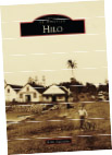 These excerpts are from Images of America HILO, by author Karen Valentine, a Na’alehu resident, and Ke Ola’s co-founder and contributer.
Contact author Karen Valentine
Images of America HILO is available from the author and local bookstores.
