To Walk with the Ancestors: Lapakahi and the North Kohala Coast
By Jan Wizinowich
Lapakahi State Historical Park (LSHP), a significant cultural complex along the leeward coast of North Kohala on Hawai‘i Island, is a time portal through which we can glimpse the thriving life of Hawai‘i’s early settlers and a touchstone for Hawaiian cultural practitioners. Once a thriving fishing village and upland field system, it is also the centerpiece of Kohala coast land preservation efforts.
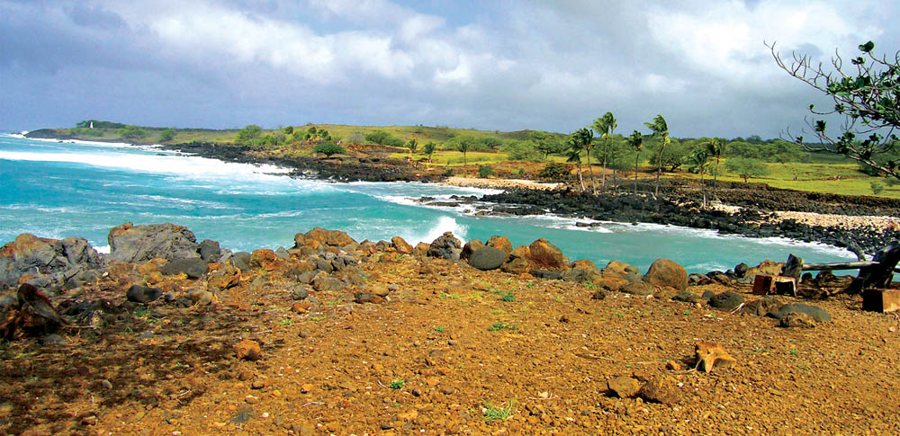
The Kohala district, a peninsula that points northwest, is unique in that it is neatly divided between windward and leeward, or i loko (inside) and i waho (outside). The leeward coast provided calm waters and rich fishing grounds and, as the population grew, an upland field system.
Evolution of an Ahupua‘a
Initial settlements were centered in the valleys on the lush windward side of the peninsula. Sometime in the 1300s it is thought that a growing population expanded to the leeward side, creating settlements such as Lapakahi.
Beginning in the late 1960s, Lapakahi has been the focus of a series of archaeological excavations initiated by Richard Pearson and Roger Green, who together conducted one of the first studies of an ahupua‘a in its entirety. Ahupua‘a generally run from the mountain to the ocean and were a functional organization in which ‘ohana could harvest and exchange resources.
Lapakahi began with Koai‘e, a fishing village located on a small cove with a coral beach and a canoe landing. There is no way of knowing for sure, but related ‘ohana probably made their way over land or traveled by canoe to find a calm landing place to settle. Now a marine sanctuary, the reef provided (and still provides) an abundance of life-sustaining food in the form of fish, shellfish, and seaweed.
Eventually, with the increase in population, the fishing village expanded upland into the dryland forest, which probably consisted of such plants as a‘ali‘i, ‘iliahi and koai‘a. Terraced fields were created and watered from the Kohala Mountain watershed, which they harnessed into ‘auwai (irrigation canals).
The population continued to expand and, starting in 1450, the Lapakahi field system was continuously developed, intensified, and divided into smaller sections with permanent boundaries. House sites evolved from temporary shelters used during the growing season to permanent residences. It is estimated that food production in the ahupua‘a peaked out towards the end of the 18th century and that most of the residents were gone by the early 1900s.
A New Era
After Lapakahi was no longer an active community, it continued to be a place of healing and knowledge. Papa Henry Auwae, a noted Hawaiian healer born in the early 1900s, spent time at Lapakahi as a child studying with kahuna lā‘au lapa‘au (traditional Hawaiian healers) there.
“There were kahuna that dealt with mountain plants and those who dealt with coastal plants, and some of the coastal kahuna lived at Lapakahi. Papa also said that the water off the coast of Lapakahi was the water used for healing,” said Momi Naughton, who interviewed Papa for the Smithsonian Folklife Festival in 1989.
Lapakahi was also visited by local Kohala residents for fishing and recreation. “The Akoni Pule highway was not there. That was very significant for Lapakahi; it was very inaccessible for many people. The only people who knew about it and used it were Kohala people and ranch people. It was and still is very good fishing grounds,” recalled Fred Cachola.
Fred, who was born and raised in Kohala, remembers trips to Lapakahi with his Boy Scout troop in the 1940s and 1950s. “The plantation truck would pick us up at the scout hall in Hala‘ula and take us to Māhukona. We’d bring canned goods and cabbage and onions. No coolers. We packed water in five-gallon military surplus water cans. We walked the coastal road, fished, swam, and earned merit badges,” said Fred. “At that time, it was choked with kiawe. It was so thick, the only way you could walk was on the trail,” he added.
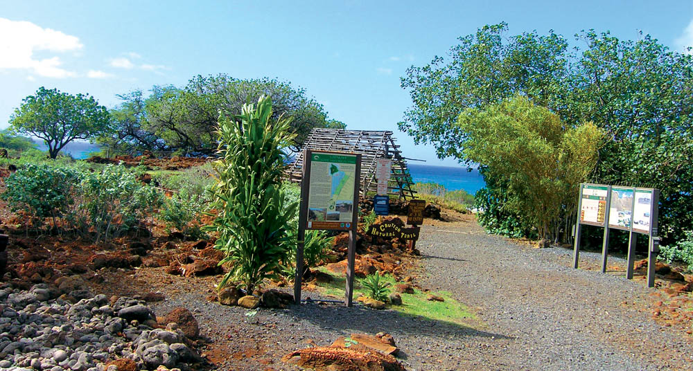
The kiawe was removed during the process of archaeological excavations, which began in the late 1960s with the Koai‘e fishing village. During a series of digs, archaeologists found the remains of a village complete with all the necessities of life.
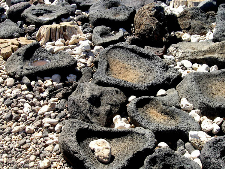
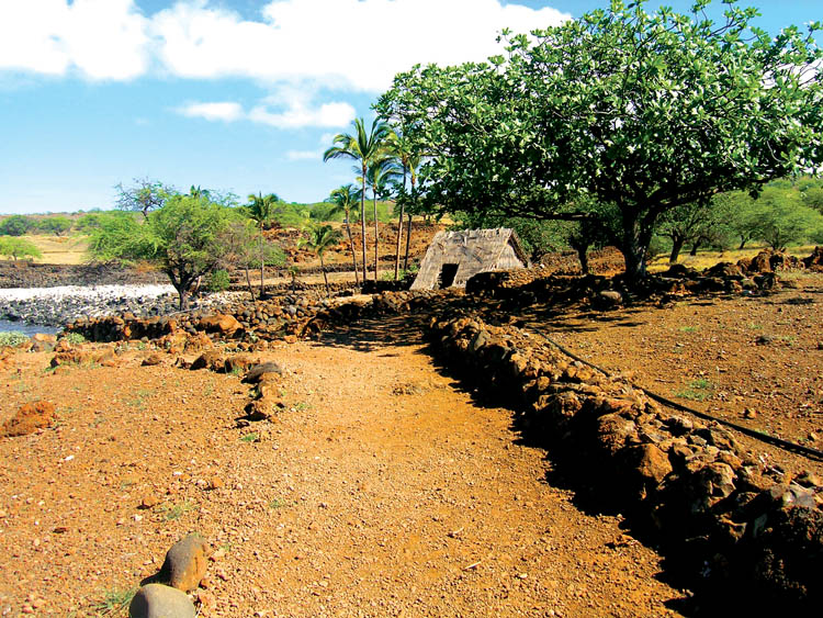
Koai‘e Cove provided a launching area for canoes with the foundations of a hale wa‘a (canoe house) nearby. Archaeologists also uncovered the remains of house sites that were lashed pole constructions on rock wall foundations and thatched with pili grass. Salt was crucial and there are several pohaku pa‘akai (salt-making stones), large flat rocks with bowl-like indentations that held the evaporating seawater. A well dug for fresh water was also found.
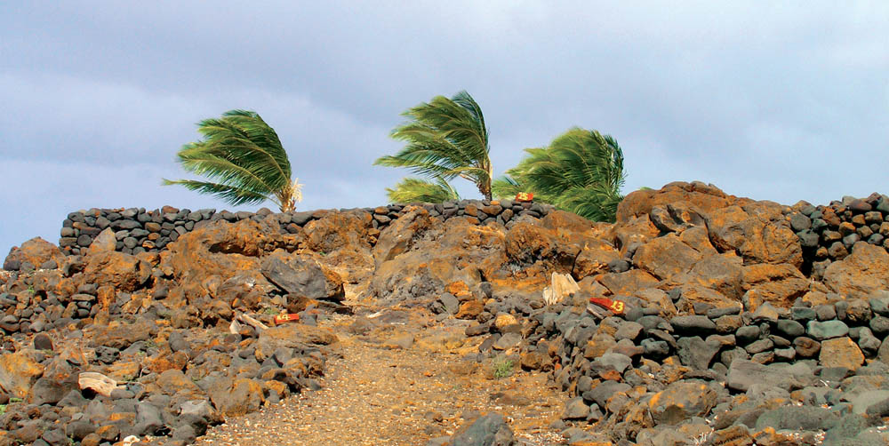
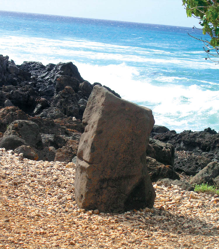
With close connections to the spirits of the land, there are the remains of a heiau (place of worship) constructed on a promontory; Ku‘ula, a stone fishing god, who received part of the fishermen’s catch, sits on the south point overlooking the ocean. Archaeologists also found several burial sites.
An extensive field system, which was part of the Kohala field system, was discovered in the upland portion of the ahupua‘a. A network of trails connected the mauka (upland) and makai (seaside) areas, as well as provided access between field sections. The main stone-lined trails were also hollowed out, perhaps to collect rain water runoff.
There are also upland house sites that evolved from temporary seasonal shelters to established permanent homes, reflecting the evolution and settlement of the Lapakahi ahupua‘a. It was in this upland area that kalo (taro) and ‘uala (sweet potato) were grown. These were shared with the shoreline fishing families in exchange for ulu, octopus, shellfish, various reef fish, seaweed, and salt.
In 1973 Lapakahi State Historical Park, which now consists of 279 acres, was established. In 1979 the park was extended to include a marine life conservation district to protect the rich diversity of coral and fish along the coast. The restoration of native plants at Lapakahi such as ma‘o (native cotton), milo, hinahina kahakai, ‘ilima, and niu (coconut) provide an outdoor botanical classroom for lā‘au lapa‘au practitioners and visitors.
The park is a place where residents and visitors can get a glimmer of what life was like in pre-contact Hawai‘i, and the healing spirit of the land lives on for members of Na Haumana Lā‘au Lapa‘au o Papa Auwae (NHLLOPA) who meet there annually in October to share and perpetuate healing traditions passed to them from Papa Henry Auwae. The NHLLOPA has also been responsible for caretaking the park since 2010, initially through an agreement with the state parks and now sponsored through the Friends of the Future.
Walking with the Ancestors
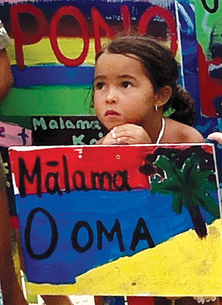
Lapakahi is a pearl amongst a strand of settlements along the leeward Kohala coast, which has the most pre-contact historical and cultural archaeological sites in the state of Hawai‘i. The spirit of the lands of Kamehameha I have called out to the hearts of the community, making the Kohala coast the focus of concerted land preservation efforts by several groups and agencies.
With the North Kohala Community Development Plan as a guide, the nonprofit corporation, Kohala Lihikai, made up of five land preservation groups, has been a driving force behind the efforts to preserve the Kohala coast as a “recreational and educational resource for future generations of residents and visitors,” according to Toni Withington, North Kohala community advocate and spokesperson for Kohala preservation efforts.
The bulk of the funding for the purchase of coastal lands has come from the County’s 2% Open Space Fund and the State’s Legacy Land Preservation Program. In addition to that the Trust for Public Lands and Hawaiian Islands Land Trust, federal grants and private donors have also contributed.
From 2010 to 2017, the efforts of volunteer groups and community members raised 20.9 million dollars and preserved 390 acres along the North Kohala coast, with many acres pending purchase. Kaiholena, just south of Lapakahi, was acquired in 2016. According to the Hawai‘i Island Land Trust (HILT), “Kaiholena was once a thriving community as remnants of heiau, massive hālau, burial sites, and village complexes are still visible. Kaiholena has been said to have numerous pre-contact intact cultural and archaeological sites in Hawai‘i with over 200 sites that qualify for the National Historic Register found there.”
Along with the acquisition of coastal lands is the need to establish access by identifying and maintaining historic trails. Organizations such as E Mau Nā Ala Hele, the Ala Kahakai Trail Association (ATA), and the Ala Kahakai National Historic Trail have added both financial and trail development resources to the preservation efforts.
The 2016 purchase of Kaiholena South by the ATA (with the support of numerous organizations and individuals), added to Kaiholena North and Central, altogether providing a total of 10 miles of protected coastline and potential trail. Preservation efforts are ongoing with the ultimate goal being a North Kohala coastline free of development and with community access for recreation, fishing, and historic preservation.
Lapakahi is a window into the past, but also the beginning of the re-awakening of Hawaiian ancestral spirits who live on through the land and the voices of the Kohala community. ❖
For more information: dlnr.hawaii.gov/dsp/
Jan Wizinowich
Jan Wizinowich is a freelance writer and community oral historian who has lived in Waimea for over 30 years. Her focuses are Hawaiian culture, conservation work and connecting through story. When she’s not writing for Ke Ola Magazine or doing oral history projects, she’s working on historical fiction.